GLOBAL WEATHER SYSTEMS
The complete world weather forecasting system
|
||||||
| Home | Forums | Oceanography | Climatology | Geology | Learning | |
Global Weather Systems
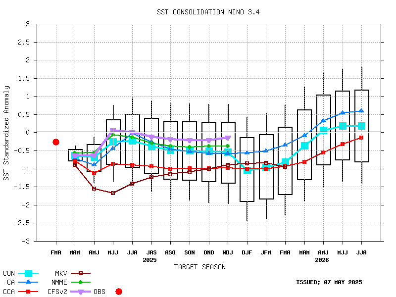
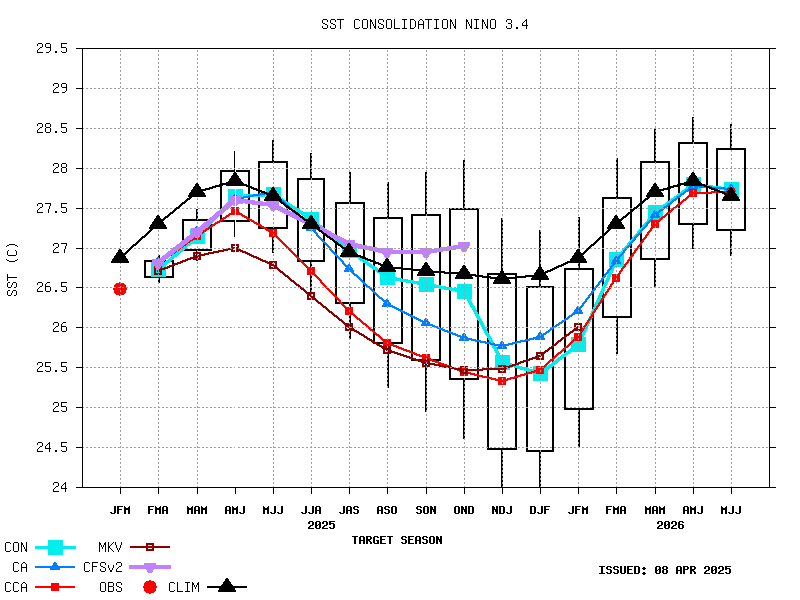
El Nino Southern Oscillation (ENSO)

Global weather systems has all the weather accross the World.Satellite images for every continent, weather pressure charts and storm news and information. Climate change and information on Al Nina El Nino and Enso. The MJO Solar weather and North Atlantic Oscillation. Everything for Weather accross the World. |
|---|


Weekly ENSO Evolution, Status, and Prediction Presentation (PDF)
PNAThe Pacific/ North American teleconnection pattern (PNA) is one of the most prominent modes of low-frequency variability in the Northern Hemisphere extratropics. The positive phase of the PNA pattern features above-average heights in the vicinity of Hawaii and over the intermountain region of North America, and below-average heights located south of the Aleutian Islands and over the southeastern United States. The PNA pattern is associated with strong fluctuations in the strength and location of the East Asian jet stream. The positive phase is associated with an enhanced East Asian jet stream and with an eastward shift in the jet exit region toward the western United States. The negative phase is associated with a westward retraction of that jet stream toward eastern Asia, blocking activity over the high latitudes of the North pacific, and a strong split-flow configuration over the central North Pacific. The positive phase of the PNA pattern is associated with above-average temperatures over western Canada and the extreme western United States, and below-average temperatures across the south-central and southeastern U.S. The PNA tends to have little impact on surface temperature variability over North America during summer. The associated precipitation anomalies include above-average totals in the Gulf of Alaska extending into the Pacific Northwestern United States, and below-average totals over the upper Midwestern United States. Although the PNA pattern is a natural internal mode of climate variability, it is also strongly influenced by the El Ni�o/ Southern Oscillation (ENSO) phenomenon. The positive phase of the PNA pattern tends to be associated with Pacific warm episodes (El Nino), and the negative phase tends to be associated with Pacific cold episodes (La Nina).
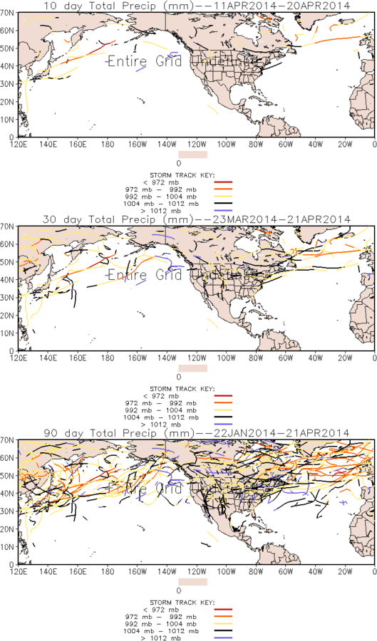
Monitoring the recent evolution of storminess across both the Northern and Southern Hemisphere. Storm tracks are identified by tracking sea level pressure minima and the following pages highlight storm tracks and important related fields (precipitation, low-level wind vectors and magnitude, significant wave heights, and sea ice) for the past 10, 30, and 90 days. Storm tracks from the Global Forecast System (GFS) are also included. All data is provided courtesy of the Environmental Modeling Center (EMC) of the National Centers for Environmental Prediction (NCEP) as part of NOAA.
|
|---|